


This one is certainly worth a blog entry. A friend of mine at work has been interested in going on a hike with me for a while now. I would throw out some ideas from time to time, but nothing ever caught his attention. That was, until I asked him what he thought about climbing the tallest mountain east of the Mississippi. His ears perked up, and before long we had hashed out a plan. I was hoping to make a nice loop, maybe including nearby Mt. Craig and Big Tom Mountain. But once Brian heard me mention "the hardest hike in the east" he insisted we tackle it. This was his first backpacking trip ever. I told him I had sufficient gear for the two of us, and that we could go pretty light. However, in a statement he would come to regret later, he insisted that I load him up. I believe the quote was, "I really want this to kick my a--." Can do sir! Lucky for me, this meant my pack was plenty light. Even after packing my full rain regalia, I had everything in the 35-liter pack I usually reserve for day hikes. I would guess it was under 30 pounds. Brian;s pack was probably between 40-45. Let me add that Brian is in very good shape. Last September he completed the Air Force marathon with a respectable time and went on to do well in an Air Force Special Forces selection school. Normally I would never subject a first time hiker to a trail like this, or to a pack 50% heavier than my own. If anyone could handle it though, Brian could.

Our plan was to start at the Bowlens Creek trailhead just outside of Burnsville, NC. Everything we read about this hike said it was an insanely grueling and very technical hike. I have read plenty of trail reviews like this before, and none of them panned out. My most recent memory was of the Rim-of-the-Gap trail in SC. This was supposed to be for the most experienced hikers... not so much. It was a great hike, but the "technical" aspects were laughable. With that in mind, I didn't expect us to have too much trouble.


After some difficulty finding the trailhead, we finally started up the ridge. We were joined for the first few miles by a pair of "bear dogs". We found out later that the black bear population around the Black Mountains has been booming the last few years. Bear dogs are just hound dogs that local hunters equip with radio collars and set them out. The dogs will run the bears for a few days, tree them, and wait. The hunters then use the collars to track the dogs, and therefore, the bears. These two followed us for quite a while. The owner finally met up with us at one of our stops.

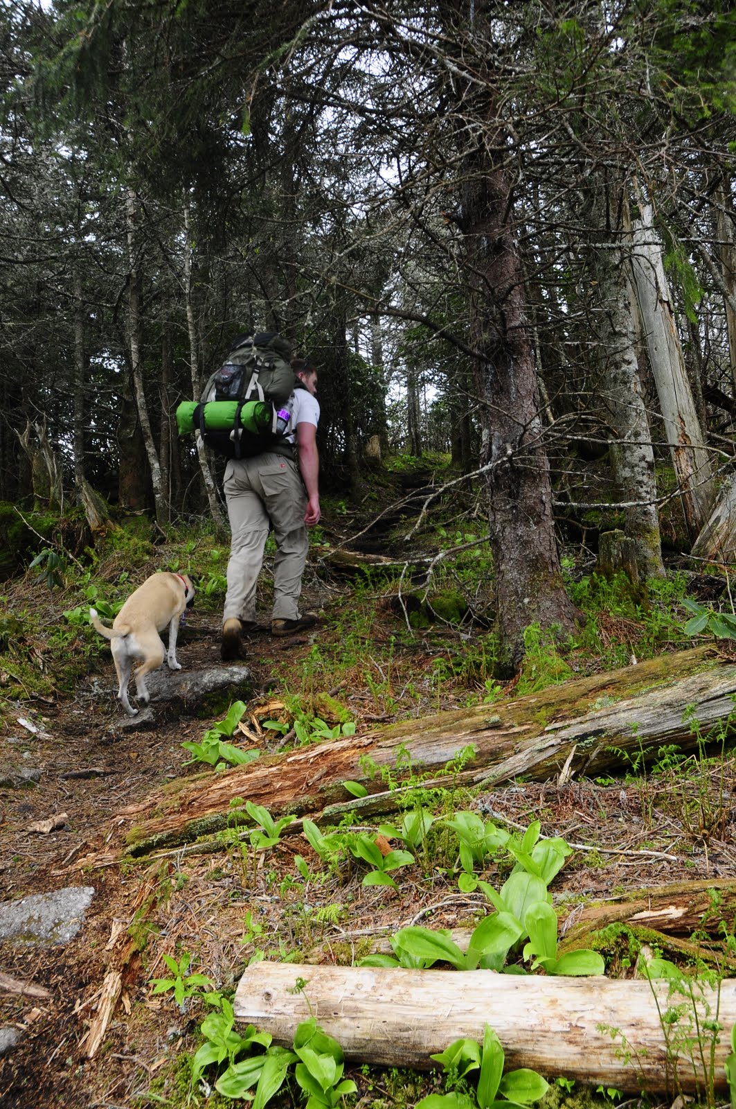
The first few miles of the hike lead me to believe all the trail reports were once again slightly over-blown. Don't get me wrong, the climb up Celo Knob (the first high point on the ridge) was grueling, but not any more than any other mountain climb. It was the typical Southern Appalachian hike: an old logging road that was slowly being reclaimed, with rhododendron lining the edges. The old growth hardwoods we hiked through were a bit of a change, though. Old growth hardwood is hard to come by in this area, since so much of it was logged in the early 19th century.


(these are new growth trees. According to the topo, this was an old heli pad)
Eventually the scenery started to change as we started to close in on 5,000 feet. The old growth turned into hemlock stands, and we finally hit the switchbacks taking us away from Bowlens Creek. We had switched back over to the west side of the ridge, and as the sun started to go down, we could just barely glimpse some of the other peaks coming into view in the distance.

We took one final water stop before making our final push up Celo Knob. We were starting to feel the burn of the 3,000+ foot climb in our calves and thighs. Luckily we hit a water source close to the peak, meaning fetching water from our campsite wouldn't be near the task we originally thought.


We pushed up and finally gained the ridge. To the north (our left), the valley was filled with clouds. Those clouds, while not masking Celo Knob, were rolling over the ridge just a few hundred yards from where we were. To the west (straight ahead of us), The sun was getting ready to drop below the distant peaks. We decided to drop our packs and enjoy it for a while.


After taking in the views for a while, we finally started to consider our evening accomodations. We began looking around but the camping spot we read about on Celo Knob was nowhere to be found.

Feeling a bit of haste due to the quickly disappearing sunlight, we reluctantly loaded the packs and continued across the ridge in search of flat and clear ground. We were getting lucky as far as the clouds go; they weren't intruding on our remaining daylight hours. We couldn't say the same for the ridgelines in the distance.

We were scooting along the ridge and came to the open space on top of Horse Rock, just past the junction with Woody Ridge Trail. So we finally found some open and flat terrain, but this terrain was a little too open. The few trees that were there only had branches on the east side of their trunks, reminding passers-by that this spot sees plenty of high winds. We finally spotted a small clump of cedars and set up the tent.

We made a weak attempt at starting a fire, then had some dinner. Not wasting too much time, we climbed into our sleeping bags. Joining us on this hike was my dog, Austin. He does really well on the trail. He doesn't usually get too over-excited at the sight of other hikers, he is very athletic, and just the right size: not so big he's a burden, but not so small you have to worry about every rock-hop. The only bad part about bringing him is that he gets cold pretty easily. But he made himself a nice spot between our bags and slept pretty well.

Come to think of it, we all slept pretty well. The least desirably portion of any hike for me is the sleeping. I almost always sleep terribly on the trail. This night however, I slept pretty well. Brian, about 2.8 seconds after laying his head down, was out cold. And lucky for us, that wind that I was so afraid of never picked up. Other than a couple of crazy night hikers that passed our tent at about midnight, we slept uninterupted.
The next morning, after Brian rolled out of his bag, I asked him what the view was like. There as a slight pause, then a flurry of adjectives and expletives. The clouds that were covering the ridge the night before had cleared out. At the same time, fog had gathered between some of the distant ridges, turning the mountain tops into islands in the sky. That, combined with the way the sun was raking across the grassy knob around our campsite, made for one heck of a sunrise.


With the clouds gone, we got our first glimpse of ridgeline as it stretched out towards Mt. Mitchell. Feeling anxious to get going, we packed up pretty quickly and broke camp right at 9:00 a.m.

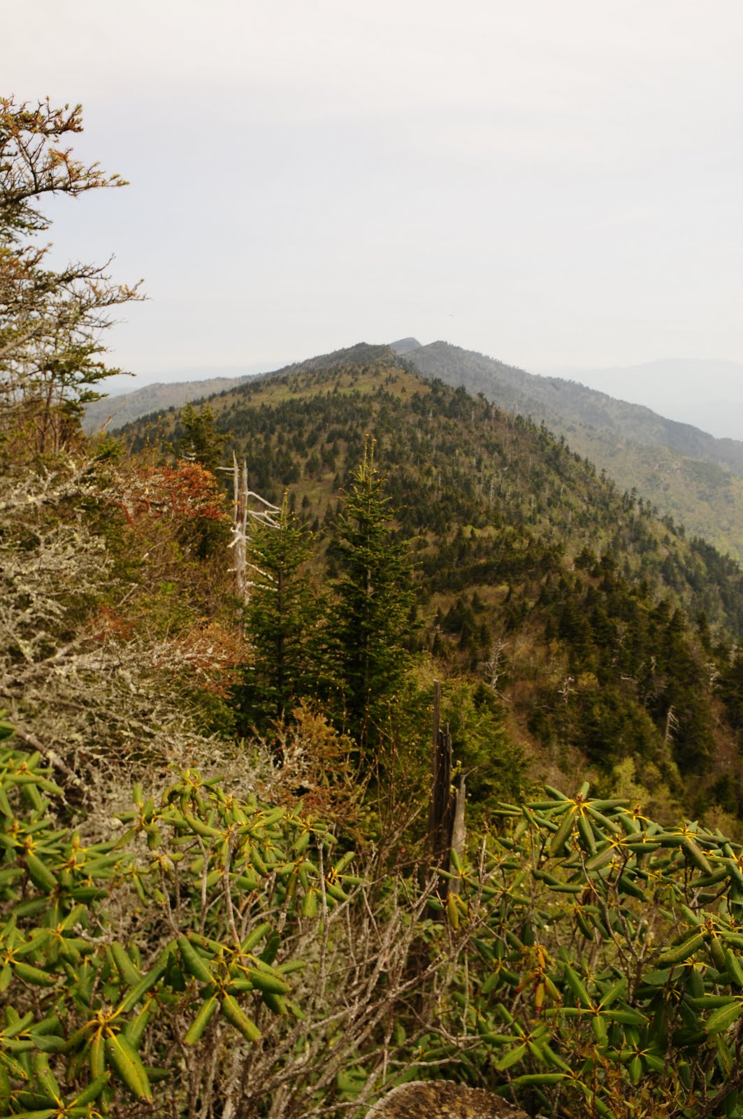
Our first obstacle of the day was Gibbs Mountain. The views just kept coming. We weren't making much progress because we kept stopping to take pictures. These views were as good as any I have ever seen and since I toted my dSLR up to the ridge, I was going to take advantage. Looking back, I'm really glad we did. I fully expected to get better views the closer to Mt. Mitchell we got but that just was not the case. It was exactly opposite. Horse Rock and Celo Knob were pretty much the high water mark for breath-taking views. Don't get me wrong, all the views on this hike are awesome but at the north end of the ridge, they are more panoramic and more frequent.


After Gibbs Mountain, we began to lose a lot of altitude along the trail. We pulled out that the map to size up our location. We were getting ready to take on Winter Star Mountain. Let me slow down here and add a little extra emphasis for any readers who may plan on tackling this hike in the future: you WILL be exhausted after hiking Winter Star!

Although Winter Star is not any higher than most of the other peaks on the ridge (in fact, it is shorter at just over 6200 feet), this is where the trail really gets technical. The rocks get bigger, the climbs are steeper, and the descent to Deep Gap on the south side of the peak is knee-busting. You will, however, enjoy some amazing views from the summit.


Deep Gap is a very fitting name for what follows after Winter Star. The entire stretch from Celo Knob to Mt. Mitchell is near or above 6,000 ft., with the exception of Deep Gap. When we reached the bottom of the gap, we dropped our packs and had lunch. We also needed to refill our water bottles here. Colbert Ridge Trail, a popular approach trail for folks trying to reach Mt. Mitchell, comes in from the east. We knew there was a creek about a half mile down that trail, but we didn't feel like losing another 500 or so feet. According to the topo map we got at the Appalachian Ranger Station in Burnsville, there was a stream exactly opposite the gap from Colbert Ridge Trail, and less than half the distance away. With that in mind we started bushwhacking down the west side of the ridge.

About 20 minutes later we returned to our packs with no water, just a little more burning in the thighs. We found an unmarked road going to who knows where, but no water. We decided that maybe we could make it to Big Tom, where the map showed water right by a small connector trail.
We pushed off, and quickly ran into a hiker coming the opposite direction. We asked him about the water sitation on Big Tom, and he laughed. "There's no water there, or anywhere, until you get to Mt. Mitchell State Park." We looked at each other dejectedly, then looked back at the man, who said, "I can show you guys a spot up here on Colbert Ridge Trail."
We went back to Deep Gap and followed the old man to a big rock with a tiny trickle underneath it (old man being a relative term. He probably was no more than 45 years old, but for a hike like this one, that's as old a man as you'll see out here). It took a while to fill the bottles with such a light trickle. In that short period of time we got an earful of Pacific Crest and Appalachian Trail hiking stories. "You guys gotta get out there and do that while you're still young. You GOT to. You can't do it when you get old like me. I finished the AT with an 80-year-old man, but guys like that are far and few between." The best line came when I asked him which was better (knowing that almost any hiker that has done both says its no comparison- PCT hands down). "Well, the PCT has so much diveristy and the scenery is amazing, but there's no sex. No girls hike the PCT, and when you do run into one, they look at you like you're a nasty hippie hiker dude." Brian and I laughed.
Now with our almost two hour lunch break behind us, we finally pushed on towards Big Tom. This is where the hike really started to drain us. The views were becoming more scarce. Our solitude was gone. Once you pass Deep Gap, you're in range of all the dayhikers doing out-and-backs from Mt. Mitchell. Some of them were as polite as you could hope for. Others had blood-thirsty dogs with them and skull tattoos.
It was somewhere between the rope climbs up and down Big Tom and the rock scrambles on Balsam Cone that we officially hit the wall. Our original plan was to reach Mt. Mitchell some time between 4 and 5, take some time to buy souveniers, then turn around and head back to Deep Gap. That was going to give us all day Sunday to make it the 7 miles back to the car at Bowlens Creek. After making the ups and downs of Big Tom Mountain, Balsam Cone, and then Mount Craig, there was simply no way we could turn around and do it again that same evening.


We finally reached Mt. Mitchell State Park at about 5:30. The wind had officially left our sails and at this point we were looking for a bailout. Being the first clear weekend of the season for the park, it was packed. We couldn't get a campsite there. Our next idea was just to get a ride back to the car. This fell through when the rangers told us any shuttle service required 48 hour advanced notice. Our last hope was a taxi. Asheville isn't too far, so maybe we could get one without breaking the bank. The young ranger, a naturalist actually, said he called the company and it would be around $200. We sank into the park bench not knowing that the heck we were going to do. Apparently our sad state was obvious to the ranger, and he somewhat reluctantly offered to give us a ride. "Oh man, thanks! Dinner, gas, whatever you want, it's on us!"
So we waited around for a few minutes while he finished up. We loaded into his Subaru and headed down the Blue Ridge Parkway. After taking some turns at NASCAR speed, we finally got our first views of the entire ridge we had just hiked. "Yeah, I've tried to hike it a couple of times, but I never even made it up Celo Knob. It's a tough one. I really don't know many people that have hiked it from Bowlens Creek. Most people start from Mt. Mitchell and go down." Hearing him say that gave me a big shot of confidence, even though I wasn't entirely confident I would survive his car ride down the winding mountain road back to Burnsville.
Being back at the car was such a relief. It felt like we had been on the ridge for a week and a half, not a day and a half. We didn't complete our itenerary but we did complete the trail. I told Brian he set the bar awefully high for himself, in more ways than one. He would likely never find a more challenging hike. He would also be hard pressed to find that many views from one trail. After all, it is literally the highest ridge in the east. Another great aspect of this trail is the plant diversity. The diversity gets overshadowed by all the amazing views but it's as good as anywthing I've seen. Even the Great Smoky Mountains National Park didn't offer this much diversity. We saw old growth hardwoods, open grassy knobs, evergreen stands with huge hemlocks, and greenery so vivid you'd think you were hiking in Olympia National Park.
Brian was sore and beat, but I think the highs outweighed the lows for him. It won't be too long before we're back on the trail. Something with a little less elevation though.


