Wednesday, November 3, 2010

Another Smokies Hit!


Can you do an over-nighter in a back-country shelter in the Smokies in October? Sort of. As a part of David's pre-departure checklist (he and Holly are getting ready to move out to the West Coast), we were going to tackle Mt. LeConte via Alum Cave Trail. The plan was to go up, stay the night in the shelter on top of the mountain, then hike down the next day via the Boulevard Trail and the AT. I knew it was going to be hectic. Alum Cave and Mt. LeConte are two of the Smokies' biggest attractions. October, outside of the summer rush, is the busiest time of the year for the park. All of the "leafers" come rushing in to see the changing colors, and of course, LeConte is usually high on their list of sites to see.


We gave the reservations office a call, and sure enough, they had handed out the last permit for Mt. LeConte a few weeks ago. We made a decision to go anyway, and see if we couldn't get away with squeezing into the shelter anyway, on the hopes that someone with a reservation wouldn't show up. After we arrived at the trailhead, that idea quickly went out the window. The parking at the trailhead was comparable to Wal-Mart on Christmas Eve. It was packed. We knew there was no way we would squeeze into the shelter. On top of that, the hike up the mountain would probably be like standing in a line at an amusement park.


With that in mind, and after some deliberation we.... well, we couldn't really come up with anything. Our options looked pretty bleak. With a quick stop at R.E.I. on the way up, we were already running about an hour and a half late. We considered just doing a day hike, and maybe staying at a hotel, but even a day hike would have us competing with the setting sun. We decided to head down to the visitors center and talk with a ranger.

Traffic was pretty much bumper to bumper, but that didn't put too much or a damper on the scenery around us. When we got to the visitors center, it was insanely busy. We made our way to the reservations office, and I asked if there was anywhere in the entire park where we could get a permit. Luckily, there was ONE shelter left that had exactly four spots left. We snatched 'em up, and hit the road.


The hike started at Clingman's Dome, the highest point in the park. This is the KING of tourist traps in the park. The "trail" that leads to the top is an asphalt-paved walkway about the width of a one-lane road. You walk right past a gift shop before reaching a huge, hideous, spaceship-looking observation tower. The Appalachian Trail, which is where we were headed, passes right by the tower. The crowds were obnoxious. I get emotionally torn in situations like these. In one sense, I'm always happy to see people getting out and enjoying the fresh air in some way. Walking up a paved trail to a concrete observation tower certainly beats setting at home all weekend watching TV. The sad part is that, most of those folks think that this is the ultimate outdoor experience. At this particular location, the sad irony of that is highlighted even more because the pinnacle of American outdoor experiences, the Appalachian Trail, passes right through here. If any one of those tourist would walk in either direction on the AT, they would be rewarded with the same amazing views they got from the observation tower, only without bumping elbows with hordes of people.


It was slightly entertaining walking up the paved "trail" on the way to the AT. Some people were pointing saying, "Look! professional hikers!". A couple of guys were asking all about our trip and where we were going and what we were going to eat, and what we were going to do if we saw a bear. It was almost a celebrity moment. We were adding to their tourist experience, allowing them a chance to see "real hikers".


We got to the AT junction and made a left (south). Our destination was the Siler's Bald shelter. It didn't take long before we were smacked in the grill with awesome panorama. David was really looking forward to get out on the Boulevard Trail, mainly because of what I told him about my hike there in April 2009 (See blog post). I told him about the ridge hike and its awesome views. We thought we were going to miss out on that, but the AT lived up to the accolades.


It was a 4.6 mile hike down a ridge that runs from Fontana Dam, up to Clingman's Dome. With the exception of about a one mile stint through a stand of evergreens, the entire hike had exposed views of either the Tennessee, or North Carolina side of the park, and in some places, both. The North Carolina side was filled with ridge after ridge of Smokey Mountain glory. You can also see slivers of Fontana Leak snaking around the base of some of the ridges. The Tennessee side, while still quite breath-taking, is still pretty epic. The mountains flatten out into the flat plains of the mid-west, and you can see the sprawl of Gatlinburg and Pigeon Forge below. Being so high up, you can even see the curviture of the Earth.


At 2.2 miles we came to Double Spring Shelter. This shelter had obviously recently been renovated. it looked extremely cozy. Even at 5:00, it was already filling up. We would find out on our hike out, that Double Spring Shelter hosted 14 guests that night, two more than its capacity allows. A couple of guys had hiked in a hand saw, and were cutting up some hearty firewood and getting a nice fire going in the built in fireplace. We had a quick snack and kept on trucking. Aside from breath-taking views, the hike in was pretty un-eventful. We ran into a big fresh pile of bear evidence about a mile from the shelter, but no actual sightings. Best of all, when we got to the shelter, we found out we were sharing with a father and son, and that was it. No big crowds.


We got settled in. Matt, the youngster we were sharing the shelter with, had already gather up some firewood, so I got to work on that immediately. We prepped some food and spent the rest of the night literally laying on the ground staring up at the stars. Night time was extremely windy, but we stayed north of freezing temperatures. The shelter's trail log was filled with horror stories about the mice (as is the case with almost all AT shelters), but we didn't have any issues.


The next morning we lounged around, taking our time getting packed up. We waved off Ron and Matt. About an hour later we departed, too. Usually the return hike, when doing an out-and-back route, is kinda lame. This time, the views were still just as grand. We caught up to Matt and Ron at the Double Spring Shelter, and had lunch. Shortly after that, the crowds started picking up again, and before you knew it we were back at the paved trail. We went up and had a peek from on top of the observation tower. The wind and the crowds made it a less than desirable experience. We loaded up and headed home, stopping at Texas Roadhouse in Asheville to top it all off. ...NEXT!

Wednesday, October 20, 2010

Table Rock... again!


This month last year, David and I braved some nasty weather and hiked up Table Rock . When we got to the top (well, near the top, actually), the clouds parted long enough for us to take in some amazing fall scenery. It's certainly the best mountaintop scenery I've enjoyed on the east coast.


This time around, we went up about a week ahead of the leaves changing, so the fall colors weren't quite there, but neither was the fall rain. We also brought along some company. David's wife, Holly, made her second Table Rock climb and I was lucky enough to be accompanied by the entire family. By "entire," I mean my wife, Laura, and 16-month-old Gabriel.


We drove straight from Augusta to Table Rock State Park, arriving around 3:30, an hour behind schedule, which is customary when traveling with David, and ended up not actually getting on the trail until around a quarter to four. The issue with the later time was that Gabriel would be approaching bedtime before we could make it down off the mountain and we had no idea how he would handle being stuck in a baby carrier while his eyes got heavy. Of course, we also had no idea how he would enjoy being stuck in a baby carrier for the hike up the mountain either.


As has been the case on all our other outdoor adventures with the little man, he was perfect. When he gets outdoors, his wheels stop turning quite as fast, he calms down, his eyes get big, and you can tell his little mind is just taking in all the scenery around him. This trip was no different.


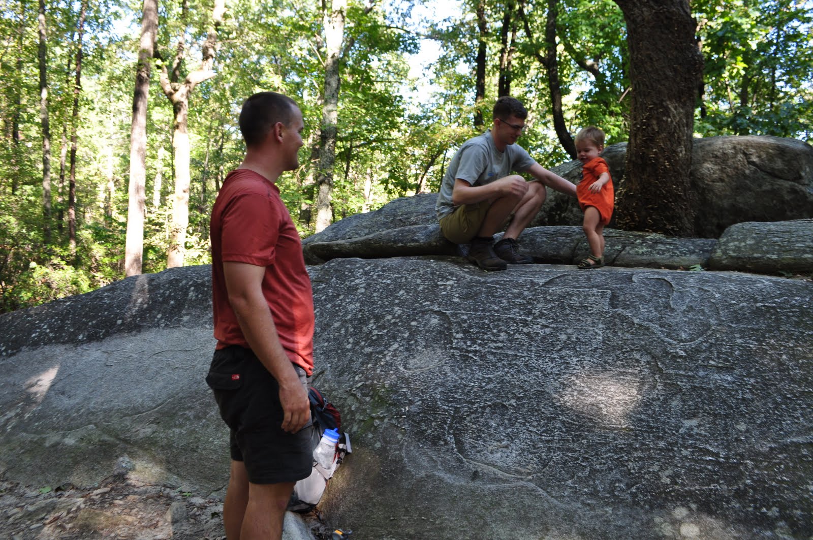
About an hour into the hike, we stopped at a large boulder beside the trail to take in some water and let Gabriel stretch his legs. David hopped up on the boulder to find a seat and the little toot headed up after him. This was a solid granite faced boulder that had a very steep grade, but he got about half-way up the 6 to 7-foot face before realizing that he was climbing on his own. Crazy little kid!! David's mom always jokes with me that because I introduced David to backpacking, I am also responsible for his rock-climbing hobby (which I completely refuse any responsibility for). Now I tell her that her son taught MY son how to rock climb, so we're even.


We loaded back up and headed up the trail. After about a half hour we came to the gazebo that marks the approximate half-way point. Near the gazebo is an exposed rock face that you can safely walk out on, giving you your first hint of Table Rock scenery.

Already running a little behind schedule, we didn't spend too much resting. With just another couple of minutes climbing, we would be at Governor's Rock. This is the place that David and I had to stop last time due to time and weather constraints. I was looking forward to going back and letting Laura and Gabriel experience the views, although the colors weren't quite popping yet.


We plopped down and let Gabriel run around and much as safety would allow. We took some pictures, drank some water, and snacked on some trail food. Again, we were in quite a race with the sunset so we didn't hang around long because I was anxious to make it all the way out to the nose of Table Rock.

After hitting the trail again, we crossed paths with a four foot rat snake. It was quickly making its way across the trail. If nothing else, it was fun to see David's fear of snakes manifest itself for a quick second. We kept moving and after crossing the official summit of Table Rock, we came to what they call "the nose."


The extra effort was certainly worth it. The views of the lake below and the landscape stretching out into the South Carolina Low Country was awesome. But again, as our race against the setting sun continued, we had to pack up fast and make a hasty retreat down the mountain.


We headed down at a much faster pace, but it was obvious we were not going to make it down before the sun set on us, so we divvied out the headlamps and anxiously awaited Gabriel's fussiness from riding in the carrier at night. Come to find out, as long as he had a handful of crackers, he was as happy as could be riding on my back. He never got fussy. He never wanted down. He was enjoying every second of the hike. The last 15-20 minutes of the hike were with headlamps on, hiking in the dark. Still, Gabriel didn't make a peep. At this time of day he would normally be having a bottle of milk while getting rocked in preparation for bedtime. He was just as content holding on to a handful of crackers hiking through the night!

We made it back to Hotel Dennis and, as always, enjoyed a weekend spending time with the entire Dennis family (despite Texas losing to Oklahoma the following Saturday). Now, Gabriel has added a second patch to his lil' pack! He'll be out of room for patches before you know it!

Saturday, June 26, 2010

Our Little Camper


It was with a little apprehension on my part, and a little more apprehension on Laura's part, that we decided to take our little man on his first ever overnight camping trip. A year ago this month, when he was only a month old, we rented a cabin in Oconee County. We had a great time doing a lot of short hikes and seeing the sights. (You can see the blog post for some of the pictures we got.)

This time it would be out in the elements. We weren't doing any backpacking, so there would be all the comforts of Oconee State Park right outside our vestibule. On the drive up, we kept thinking of all the worst-case scenarios. What if it gets too busy, and the park is too loud for him to sleep? What if birds or other things wake him up in the middle of the night and his screaming wakes up everyone else? What if he gets too hot or too cold at night? Well, everything went absolutely perfect.

When we are home, Gabriel loves being outside. It's pretty much a sure-fire way to calm him down if he gets grumpy...just take him outside. It was much the same when we got to the campground. First, we stopped by Chau-Ram County Park just north of Westminster, SC. Ramsey Falls is located here, with tons of picnicking areas located above it. Ramsey Creek then flows down into the Chauga River. On the river there are nice hiking trails, and a really scenic suspension footbridge. Below the bridge the river has a nice little island sandbar that is perfect for kids to play on.


As great as the park was for playing in the water, the campground left a lot to be desired. The sites were packed in on a tight pretty tight loop on a steep hillside. They seemed to be well put together, but just a little too close for our liking, not to mention the place was already pretty full and it wasn't even noon. So after we got all our playing out of the way, we decided to head on over to Oconee State Park. We spent a little time over at their really busy, but really neat swimming area. It was closing in less than an hour, so we really didn't have much time. But we let the little guy ruin another diaper and take a dip.

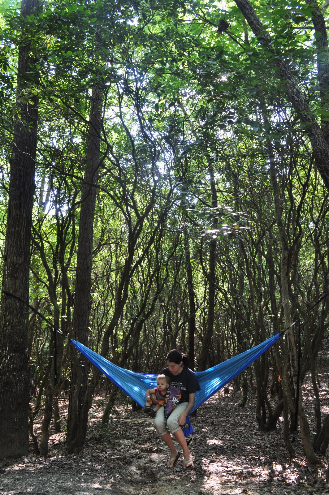
After that we went and settled into our campsite. The later it got, the more nervous we were about how Gabriel would handle going to bed out in the woods. We had his pack n' play set up in the tent, so it was at least a bed he was used to, just in a less familiar setting. Laura headed to the bathouse for a shower, and I rocked Gabriel in the hammock. It was no time at all before he was out cold, much to my surprise. I got him over to his bed and he was fast asleep. Even as the rangers drove by on the gravel road (which was only about 20 feet from the tent) there was no peep out of him. We had some hot dogs, played some cards, then headed to bed ourselves. Judging by energy levels in the morning, it appeared that the rookie camper slept better than anyone else.


The next day, we headed back to the park office, bought the little guy a t-shirt to remember his first camping trip with, and got checked out. We decided then to head down to the Walhalla State Fish Hatchery. If you are ever in Oconee County doing some camping with the family, be sure not to pass this place up. It's free, and any young fishermen in the group are sure to love it. Our only danger here was keeping Gabriel out of the trout tanks. We spent a few minutes here before finally packing up and heading back home.


Now that the first one is out of the way, this opens the door for many, many more camping trips. They'll take on a different look than the camping trips we have gotten used to. No hours of hiking to riverside seclusion. We'll be camping car side in local parks with campsites that have power outlets and water spouts, but at least we will be outside. We'll have to save the primitive camping for a time when Gabriel's feet get big enough for hiking boots.

Thursday, June 17, 2010

1 Down- 98 to go!

The countdown is on!!! the first trail has officially been marked off the list.

RIM OF THE GAP TRAIL

This was my selection for South Carolina. It is located in Caeser's Head State Park in the upstate area, of course. The BACKPACKER Nation selection (Raven Cliff Falls Loop) is also located in this state park. David and I have been out to this park a couple of times. Although my experience within the boundries of state parks is limited, I haven't been to one in the south east that has a better trail system than this one. If you throw in the very closely neighboring Table Rock State Park, I think its the hands-down winner. I've decided that my blog should be more photo's and less words, so I won't get into too much detail about the trip.

The Rim of the Gap trail is considered very technical, and gets a lot of mixed reviews from local hikers. A lot of people love its difficulty for two reasons. First, they love that it scares off most day hikers, keeing the trail traffic low. Second, they just love the challenges it offers. But some people hate it for that same reason. Rarely does anyone argue the scenery though. I can say that I was blown away by the trail. We were on a strict time limit to be back in Greenville for dinner, but I blew that because, for the first mile of the trail, there was waterfall after waterfall, and huge exposed granite faces. You could tell that during the winter months, views of Jones Gap below would be stunning. Even in full foliage we got some pretty awesome vistas. This trail was certainly no let down. Simply put, it was jaw-dropping.

For more information on Rim of the Gap, and other Caeser's Head trails, check out their website.


This is the overlook platform that is located a short walk from the Caeser's head visitor's center. Its an awesome place with amazing views of neighboring mountains, including Table Rock.


This is one of many small trickling waterfalls cascading over exposed granite faces. There are probably close to a dozen in the first mile of this trail.


....and again.


and again...


.and again. There were tons of opportunies for great pictures, but I had already slowed us down substantially with all the picture taking.


This is just one of many "technicalities" you have to maneuver while on the trail. I felt they were well maintained and as safe as they could be.


This shot gives you a little perspective on how the trail was truly skirting the rim of Jones Gap


More granite and running water.


The hardest thing was trying to get a good picture that showed just how big and imposing these granite faces where.


One of the reasons I thought this hike was the perfect SC hike was, after negotiating the trail as if skirted the upper rim of jones gap, for the last section, like walking into a new geographical region, you were back on typical Carolina terrain; an old logging road converted into trail. This was where the spine of the ridge flattened out, heading into Jones Gap State Park


There were well-placed man-made objects to help with the difficult terrain throughout the trail, but this one gave me a laugh. David had been talking about this "cable repel" for about an hour before we got to it, really making it sound like a dangerous undertaking. It, infact, was nothing of the sort.


And just when I thought the hike couldn't get any better, it did. The Rim-of-the-Gap trail ends at Jones Gap State Park. This park and Caeser's Head State Park share the same trail system, but have visitors' centers located at opposite ends. This entire area is called the Mountain Bridge Wilderness. Its an absolute must for any hiker looking to spend some time in the Souch Carolina portion of the Appalachian foothills.

At this point, the trail brings you down to the park visitor's center, and the Middle Saluda River. Again, if it wasn't for our time crunch, I could have spent every hour of daylight taking pictures of the scenes at this park. But we were running well behind schedule at this point. Without much delay, we filled up our water bottles, and used the Jones Gap trail, along with a couple of small connectors at the opposite end, to make our way back to the car.


The picturesque park office at Jones Gap, which is open from 11 a.m. to noon... seriously.


The Jones Gap Trail follows the Middle Saluda up the valley floor. After about an hour, you come to the very short spur trail for Jones Gap Falls. It's a really nice waterfall cascading about 65-70 feet, I would guess. The only frustrating thing about this waterfall was, no matter where I took the picture from, the waterfall came out looking like it was maybe 20 feet tall.


More Jones Gap Falls.


At this point in our trek, I really put the camera away for the most part, because we were all but sprinting back up the trail. The humidity from a passing storm system was really thick, and we were in a hurry! But the valley floor was really awesome. The trail was in great condition, following an old logging road grade along the banks of the river.


This is towards the end of our hike, where the trail finally left the river, and headed back up the valley wall to meet up with the connector trail.


(I have no idea what kind of flower this is)


This ones the last footbridge, over a small stream as it dropped into the Saluda River


We finally met up with the connector that took us from the Jones Gap Trail back to the parking lot. (And we made it in record time!)


And we're back. We both talked on the way home how we wish we would have gotten to the trailhead about 4 hours earlier, so we could have really taken our time on the hike. Even with the time crunch, it was one of the better day hikes I have done. As far as South Carolina goes, this is as goos as it gets. I think the readers of BACKPACKER avoided voting for this trail because of the technical portions. I would agree that, even as an experienced hiker, you shouldn't go this one alone (and thats coming from someone that does most of his hiking alone). Be sure to find a trail partner before you try and tackle this one. And, while I am sure the views of the gap are way better during the winter, it there is any risk of ice, stay away from this trail. But if the conditions are ripe, this trail is worth the undertaking.


Well, the competition is underway, and its out of the gates with a bang! I've debated exactly which trail to get started with. Being that I currently reside in Georgia, I thought maybe the two GA trails would be the most fitting start. I also considered started in North Carolina, in the Smokies, one of our nations true hiking Meccas. But now that its done, its hard to imagine a better start than this one. The bar has been set, and its high!

Sunday, June 6, 2010

Eddie vs. BACKPACKER nation!

So here’s my newest plan. The blog post before this one was my state-by-state all star list. I took a few boring days at work and compiled a list of what I thought would be great hikes, bikes, or paddles, in each of the 50 states, one for each state. Before I go any further, I have to say that there was no exact scientific formula employed here. In some states, I purposefully went away from premier areas, and opted for lesser known locations. For example, the obvious choice for the state of Tennessee would be one of the many excellent trails located in the Great Smoky Mountains National Park. Instead, I listed a trail located in a pocket wilderness. I had already highlighted the Smokies for my North Carolina hike, and, as great as the park is, didn’t want to double-dip. And of course, in some states, I did in fact try to highlight key areas. In California, it has to be Yosemite, just as it has to be Yellowstone for Wyoming, and the Sawtooths for Idaho. I used trails.com for 90% of my research, backing up my decisions with other various online sources and hiker reviews. A majority of the Midwest states didn’t have much to offer on trails.com, so I had to search long and wide for lesser known internet sources. Some of those states surprised me. I figured surely that Oklahoma would have a decent showing, but indeed they didn’t. An eye-catching activity in Kansas and Nebraska was almost non-existent. None the less, after about a week the list was finished, and all-in-all I felt pretty satisfied with the results.

And then it hit me! I remembered a little over a year ago getting an issue of BACKPACKER Magazine that highlighted a state by state list of favorite hikes, as voted on by subscribers. I had to do some digging to find the old issue, but alas there it was. Now, the way this worked was, BACKPACKER posted online polls for its readers to vote for what they considered to be the best hike in each state. You can tell their results were completely unedited and printed “as-is”. Rhode Island’s hike was a .13 mile walk up a gravel road to the state’s high point, which rises to a not-so-jaw-dropping 812 feet. And better yet, Delaware’s insert in the magazine simply reads “sorry Delaware, your state’s best hike is in Virginia.” WHAT!? Virginia and Delaware don’t even share a border! If anything, I certainly appreciated the editor’s attempt to print a raw list of favorite state hikes, but in some cases, I was not impressed.

Now, when I first got back in touch with this issue of BACKPACKER, I was originally planning to scrap my list, and start checking of hikes from theirs. But after being, for lack of a better word, un-flattered by their results, I decided to up the ante! I was going to go head to head with BACKPACKER nation! I decided to put the lists side by side, try to hike all 100 trails (oh wait, 99. Sorry Delaware), and see who comes out on top. Let’s see who can pick a better trail. I understand that my critics out there will say that, right out of the gates, my system is flawed. “Surely you will pick your hike over the BACKPACKER readers’! You know the kinds of hikes you like. Not to mention you will be more likely to rate the hike from your list higher for the sake of preserving your own credibility.” In the words of Lee Corso, “Not so fast, my friend!” My response to these two comments would this: 1. On my list, I have every kind of hike imaginable; from peaks, to valleys, to short day hikes to over-nighters. I also added a handful of bicycling and paddling trips into the mix! Anyone that hikes with me, or reads the blog, knows that I love a good waterfall hike, but I know when a good summit or vista hike has beaten out a waterfall hike. 2. I’m not interested in making my list beat out the BACKPACKER nation list. I am really just using this as a neat excuse to get Laura to let me do more hiking! I have nothing invested in my list. Whichever list loses in this friendly competition, one thing is for sure, I STILL WIN!
Let the games begin.

Saturday, May 8, 2010

The List(s)

... because Laura wanted me to put the lists up, too.

Eddie’s Adventure Bucket List

I. LONG HIKES.
1. JOHN MUIR TRAIL
a. DETAILS: THE JOHN MUIR TRAIL STARTS IN YOSEMITE VALLEY AND TRAVELS 215 MILES TO MOUNT WHITNEY. PERMITS ARE REQUIRED, AND THE RECOMMENDED TIME FOR THE HIKE IS BETWEEN THREE WEEKS AND ONE MONTH. (JOHNMUIRTRAIL.ORG)
2. THE GRAND CANYON
a. THERE IS NO INDIVIDUAL “GRAND CANYON” TRAIL, BUT THERE ARE OVER 300 MILES OF TRAILS WITHIN THE GRAND CANYON NATIONAL PARK.
3. COLORADO TRAIL
a. DETAILS: THE COLORADO TRAIL IS LISTED AS BEING 500 MILES FROM DENVER TO DURANGO. REPORTS SAY IT TAKES FROM FOUR TO SIX WEEKS TO COMPLETE. (COLORADOTRAIL.ORG)

II. PEAKS.
1. MOUNT WHITNEY
a. DETAILS: PERMIT REQUIRED. PER MOUNT WHITNEY TRAIL; FROM THE BASE CAMP, WHICH IS AT 12,039 IT IS 4.7 MILES TO THE 14,491 FOOT PEAK. THE PERMIT IS FOR A DAY HIKE ONLY. 50 PERMITS A DAY ARE GIVEN. CAN BE RESERVED BY MAIL.

III. RIVER TRIPS.
1. COLORADO RIVER
a. COMMERCIAL TRIPS ARE AVAILABLE FOR PURCHASE. EVERYTHING FROM 3-18 DAYS. LOOKS LIKE TRIPS LASTING ABOUT 5 DAYS ARE ABOUT $3K.
b. THERE ARE ALSO NON-COMMERCIAL PERMITS THAT ARE GIVEN OUT BY THE NPS ON A WEIGHTED LOTTERY SYSTEM. THESE TRIPS ALSO VARY IN LENGTH.

IV. NATURAL SITES.
1. MT. McKINLEY
2. YOSEMITE FALLS
3. BIG BEND NAT’L PARK
4. OLD FAITHFUL
5. CRATER LAKE
6. THE BADLANDS
7. NORTHERN LIGHTS


V. COASTAL HIKES.
1. (COASTAL MAINE)
2. HAWAIIAN ISLANDS
3. CALIFORNIA’S LOST COAST


VI. INTERNATIONAL.
1. ANNAPURNA CIRCUIT
2. PERU
3. SUB-SAHARAN AFRICA
4. BRITISH COLUMBIA, CANADA
5. ANGEL FALLS, VENEZUELA
6. BRAZIL
7. NEW ZEALAND


VII. MISCELLANEOUS.
1. HORSEBACK CAMPING IN THE ROCKIES
2. DOG SLEDDING IN ALASKA/CANADA
3. PADDLE THE FLORIDA KEYS


....and the state-by-state list...

ALABAMA:
Rice Creek/Mound Island: This canoe trip is a loop around Aikin Island in Southern Alabama. It also passes Mound Island, a Nat’l Historic Landmark of ceremonial Indian mounds. Total distance is 11.5 miles. Guidebook puts it at a 7 hour trip.
ALASKA:
Denali National Park: Denali Nat’l Park does not have established trails or backcountry campsites. You are free to roam the area on your own.
ARIZONA:
North Kaibab Trail: This trails starts on the North Rim of the Grand Canyon. The total out and back distance is 28 miles. The trail head is at 8300 ft. and the low point is at 2500 feet. Many people elect to hike out to the South Rim, which is less strenuous, for a rim-to-rim hike.
ARKANSAS:
Eagle Rock Loop Trail: The trail is 26.8 miles long, the longest loop hike in the state. The loop actually encompasses a series of trails, and has multiple access points. The trail rating is moderate to difficult.
CALIFORNIA:
The Panorama Trail: Located in Yosemite Nat’l Park, the trail starts at Glacier Point. It is 10.4 mile out and back, but there plenty of options to extend the hike throughout the valley. The hike is rated Moderate.
COLORADO:
Conundrum Creek Trail: This is a 19.8 mile hike to the Conundrum Creek hot springs. This includes a short additional hike up to Triangle Pass. There is an option to return via East Maroon Creek. Approx. 4000 feet of elevation gain. This trail is rated Moderate and Strenuous for the climb after the springs
CONNECTICUT:
Fishers Island Sound/ Mystic Seaport to Stonington: This paddle is 12.5 as laid out in the guidebook. It loops deep into the harbor, and passes several islands outside the port. The guide book warns of boat traffic.
DELAWARE:
Southern Delaware Heritage Challenge: This is a 115 Mile bicycling loop located in southern Delaware. It is said to be easy in rating. It meanders through some nice rural landscapes and through historic small towns. Starts and ends in Bridgeville at the RAPA factory.
FLORIDA:
Hells Bay Canoe Trail: Launch 8 miles north of the main office. There are 3 options to extend this trip, giving you the choice of 6,8, or 14.5 hours round trip. Permits required for backcountry camping.
GEORGIA:
Appalachian Trail Approach: Amicalola Falls State Park to Springer Mountain. Distance is 7.4 miles one-way, with about 2,000 feet of elevation gain. {Consider either a point-to-point, or loop hike}
HAWAII:
The Kalalau Trail: Located on Oahu, this trail is 22 miles long and includes amazing cliffs, waterfalls, beaches, and rain forests. There is camping available along the way. It has a rating of difficult.
IDAHO:
Grand Saw Tooth’s Loop: This 63 mile loop hike gives you the grandest views of Idaho’s Saw Tooth Mountain Range. The guide points out that there are several chances to shorten to hike if necessary.
ILLINOIS:
Chicago River Paddle: This is an 8 mile round trip paddle up the Chicago River that meanders through downtown Chicago. It is considered the best urban paddling in the country. It is rated beginner.
INDIANA:
Beach Trail: This trail is located in Indiana Dunes State Park, just outside of Gary. It is a 7-loop up the coast and over coastal sand dunes. It is rated strenuous, but there is only 200 ft of elevation gain.
IOWA:
Maquoketa Caves State Park: This park has numerous caves, more than any other state park in Iowa. It also has a trail system that links all the caves together.
KANSAS:
Lewis & Clark Bike Trail: This bike ride follows the path of the Lewis & Clark expedition for 75 miles, from Weston, Missouri, to Falls City, Nebraska. Only about 36 miles of the trip are actually in Kansas.
KENTUCKY:
Courthouse Rock and Double Arch Trail: Highlights of this trial include a double arch carved into a cliff, and an office-building sized rock. The trial is a 6.1 mile loop. Nearest town is Slade, KY.
LOUISIANA:
Grand Isle State Park: Multiple options for paddling into the Gulf of Mexico. The state park is located at the end of HWY1.
MAINE:
Mount Katahdin via the Knife’s Edge: Considered to be one of the best day hikes in the East. It’s a loop hike that gains about 4000 ft, and covers almost 10 miles. It is located in Baxter State Park.
MARYLAND:
Appalachian Trail, Harper’s Ferry to Pen Mar County Park: This is the entire MD section of the AT. Considered moderate, only because of the length. Easy elevation. Approx. 40 miles.
MASSACHUSETTS:
Cape Cod National Seashore: Cape Cod National Seashore offers numerous hiking and bicycling trails.
MICHIGAN:
McCargoe Grove to Rock Harbor: Located on Isle Royale Nat’l Park, which is an Island off Michigan’s Upper Peninsula. This hike requires a ferry reservation. It is 15.6 miles round trip.
MINNESOTA:
Clearwater Lake Loop: Consider the most scenic of Minnesota’s BWCAW. The total loop is 35 miles and is said to take 7-8 days, depending on wind.
MISSISSIPPI:
Vicksburg National Battlefield Park: Bicycling is a great option for view this historic landmark. Audio and GPS tours are available.
MISSOURI:
Taum Sauk Mountain Trail: 3 miles in Taum Sauk Mt. State Park. It also takes you past Missouri’s longest waterfall. Elevation gain is minimal. The trail is rated easy to moderate.
MONTANA:
Avalanche Lake Trail: This 3-mile trail is located in Glacier Nat’l Park. It has relatively easy grade, but expect crowds. Consider adding additional Lake McDonald area trails.
NEBRASKA:
Lewis and Clark Trail: (See Missouri)
NEVADA:
Tahoe Rim Trail. Spooner Summit to Kingsbury Grade: This is a 13-mile segment of the TRT that offers awesome views of Lake Tahoe. The elevation gain is 1500 ft, and the trail is rated moderately difficult.
NEW HAMPSHIRE:
Mount Washington Trail: This is a 17 mile strenuous trail. Trying this in winter is obnoxious. Remember, Mt. Washington has some of the worst weather in the world. There is an observatory at the top. There is almost 4500 ft of elevation gain.
NEW JERSEY:
Island Beach State Park: This is a 16.2-mile bike ride on New Jersey’s Island Beach State Park. They are a set of barrier islands on New Jersey’s shore, said to be the prettiest part of the entire NJ shore.
NEW YORK:
Hunter Mountain Trail: This is a hefty 7.2-mile trail up to the Catskill’s 2nd highest peak. Beautiful creeks and views all along the way. Consider a return hike via Devil’s Path trail. Rating is strenuous.
NORTH CAROLINA:
Big Creek to Mt. Sterling: This would be a multi trail hike. Big Creek Trail is an easy 10 miles. Swallow Fork trail will connect you to Mount Sterling. AT could be a connector instead of Swallow Fork Trail.
NORTH DAKOTA:
White Butte: This isn’t a hike, bike, or paddle. Not much offering in ND. The location is on private property, but is still open for visiting with permission and a $20 donation. Be there at sunset!
OHIO:
Magical Pelee Island: This is a 33.5 mile bike ride through the historic island located in Lake Erie. You have to get there by ferry.
OKLAHOMA:
Quartz Mountain Nature Park, Wichita Mountains State Park: This area is not well published, but there are numerous scenic short trails to mountain tops for sweeping vistas. See park offices for trail maps and more info.
OREGON:
Crater Lake’s Rim Drive: It is only open in the summer, leaving all other season for hikers, snowshoe-ers, and cyclists. The road is 33 miles, following the crater rim.
PENNSYLVANIA:
Rickett’s Glen State Park: “Simply put, the best hike in Pennsylvania.” This state park is loaded with waterfalls, about 3 every mile of hiking. And there are more than 7 miles of hiking trails in the park.
RHODE ISLAND:
Bristol Harbor to Prudence Island: This is a 13 mile paddling launching from Independence Park at Bristol Harbor, and circling Prudence Island. You do cross a large shipping lane on the way. Consider going between October and April for seals.
SOUTH CAROLINA:
Rim-of-the-Gap Trail: This trail skirts Jones Gap, located in the Mountain Bridge Wilderness area. The trail starts in Caeser's Head State Park and lead down to Jones Gap State Park. Return via Jones Gap Trail. Trail is rated very strenuous and is extremely technical.
SOUTH DAKOTA:
The Badlands National Park: Although there is no long trail in the park, there are a few short, scenic trails offering views of the rock formations. Consider the 5 mile Castle Trail, the longest in the park.
TENNESSEE:
Virgin Falls Trail: This is a 9 mile round trip hike. There are many small falls and caves along the way. At the waterfall, there is a primitive campsite. Best hike outside of the Smokies.
TEXAS:
Guadalupe Peak Trail: Located in Guadalupe Mountains Nat’l Park. The trail is 8.4 total miles, starts at 5900 feet, and peaks at 8700 feet. The trail is rated difficult, and can be done as a day hike.
UTAH:
Arches National Park Trails: This little national park offers 18.5 miles of trail. The park recently added 3,000 acres of Lost Springs Canyon.
VERMONT:
Moose Mountain Trail: This is a series highlighted by Backpacker.com. It is about 9 total miles, counting a spur trail. Amazing views.
VIRGINIA:
Old Rag Mountain: This is considered one of Shenandoah Nat’l Park’s premier attractions. There is no one trial to the top of the mountain, so no exact distances are given. The park says to allow for 7-8 hours. Primitive camping is allowed on a very limited basis on Old Rag.
WASHINGTON:
Central Alpine Lakes Loop: This is a section of the PCT. It is a 35 mile loop that incorporates some of the local trails. You will gain over 4,000 feet. There is an option to do a 75 mile point to point on the PCT in this area, requiring a shuttle.
WEST VIRGINIA:
Waterfalls of New River Gorge & Greenbrier Valley: This description is from Kevin Adams, same author of the NC Waterfall and Photography book. A host of waterfalls are detailed in the famous New River Gorge, and other notable falls from the Greenbrier Valley area are listed.
WISCONSIN:
Deer County Classic: This is a 79 mile ride, with the option to add 25 and 43 more miles. It circles the Green Bay peninsula, starting in Sturgeon Bay. It is considered to by Wisconsin’s version of Cape Cod. There are numerous historical buildings and lighthouses, coupled with awesome views of the lake and bay.
WYOMING:
Yellowstone National Park: There are just too many things to see in this park for me to list one hike. Among those must sees are; Old Faithful, The Hoodoos, the sulfur pools, the famous waterfalls, the bison, the elk, and the wolves. If a trail is on the list, consider Observation Peak.

Friday, May 7, 2010

Bucket List & All Star List

Sorry, no pictures this time. So there I was sitting at my work computer on a very slow night, trying to think of something to do. Then I started thinking about hiking. Then I started thinking about all the hikes I wanna do some day. BAM! I'll make a bucket list. I thought it would take me all night. There are so many hikes out there I just gotta do before I kick the bucket. Well, after about 30 minutes I was done. This is in part because of two things: one, there are certain hikes that are always on my mind, so those got jotted down in no time (i.e. the Grand Canyon, John Muir Trail), and two, all the other ones that I read about in Backpacker Magazine or elsewhere on the internet were fleeting my mind.

So with that done, I decided to get a little more creative. I decided to make a list of all 50 states, then list one, and ONLY one, hike in each state that I would like to do. Now, some states simply don't offer any decent hiking, so I decided that other outdoor activities qualified. For example, in a lot of the coastal states, I have paddling trips, and in some of the flatter mid-west states I have bike trips. I tried to mix it up a bit. Now, it's not necessarily meant to be the "best" hike in each state, just a good one. Some states were nearly impossible to narrow down to one hike, like California and Washington, and some states were nearly impossible to find anything in at all, like Kansas and Nebraska. But, alas, the list is done.

I'd love to get some input from other folks on what they think would be a good addition to either of these lists. If you know of an awesome trail in Wisconsin (or paddle or bike ride), let me know and I will take it into consideration. Now, if I can knock out about five of these trips a year, it should only take me a mere ten years to finish the list. I'll keep you posted!